When John Giraldo and I watched the plane float away above the Yentna Glacier a few weeks ago, I was a little bit surprised, to say the least. For the past year, John and I had been anticipating a trip to the Revelations, for which we had won a McNeil-Nott award through the American Alpine Club. But with low clouds sitting between us and the Revelations for almost a week, our pilot suggested we fly into the seldom-visited area on the southwest side of Mount Foraker.
One of the primary qualifications for the McNeil-Nott Award is “the remoteness and exploratory nature of the objective.” Looking around at the massive peaks, some of them unclimbed, I knew we had made a good decision. We were in the popular Central Range, but in a seldom-visited part of it. Most people go to the Ruth Glacier, the Tokositna, or Kahiltna (the jumping-off point for Denali’s West Buttress). Any of those places usually have lots of people during the spring. What was so amazing about the Yentna was that it was close to these other places, but still maintained its feeling of remoteness. As soon as our pilot left, we were completely alone. Until he returned for us 10 days later, we wouldn’t see anyone else.
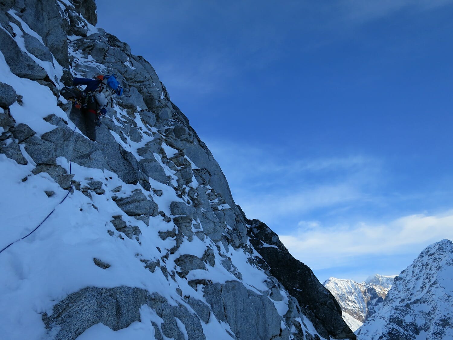
Climbing low on the east face of Mount Gabriel during the first day. (Climber: Jason Stuckey; photo credit: John Giraldo)
For the first few days there was some light precipitation, but the weather was actually pretty good. This time was spent skiing around the glacier and doing some reconnaissance. The east face of an unclimbed, unnamed 8,550-foot peak caught our eye. The climbing looked interesting, and it would give us an opportunity to warm up and get a feel for the area.
Well, our warm-up turned out to be far more time-consuming than we had expected. As I postholed through waist-deep snow right off the glacier, I was happy for the thousands of step-ups I’d done while training with Steve House for the last year and a half. I was far fresher than I might have been in years past when we finally made it to the face. Unfortunately, the rock was not as good as we thought, and we delicately and painstakingly worked our way past loose blocks and snow-covered slabs. We had been expecting, or at least hoping, to top out before dark, but did not reach the summit ridge until midnight. The plan had initially been to continue along the ridge to the summit, but with a surprisingly complex set of gendarmes ahead of us, we decided to head down. We rappelled off the first gendarme into a giant couloir and downclimbed 3,000 feet back to our skis.
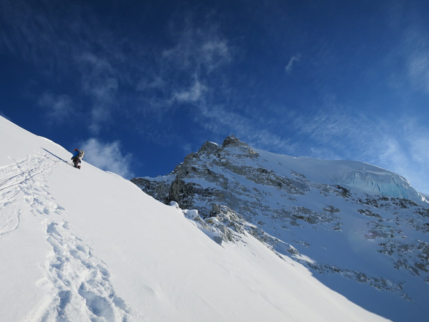
Jason Stuckey on the ridgeline below the summit of Mount Gabriel. (Photo credit: John Giraldo)
For the next few days, we rested and discussed our options. We had thought about maybe trying to repeat a route on the Bats Ears (one of the few climbs previously done in the area), but decided we weren’t really moving quickly enough over technical terrain to make that a realistic objective. Besides, we clearly had some unfinished business with our “warm-up” route. So the decision was made to try that again, but not just to the summit. This time we would climb to the summit, down to a col, and then continue along a narrow corniced ridgeline to the summit of Mount Laurens—a big, snowy, glaciated peak that had only been climbed twice before.
We packed three days of food and fuel, pared down our rack to almost half of what we’d previously taken, and headed off. This time the climbing went quicker, and much more smoothly. Back to our high point at 7 p.m., we found a nice sheltered spot on the ridge, dug out a platform in the snow, and hunkered down for the evening.
Our first bivy below the summit of Mount Gabriel. (Photo credit: John Giraldo)
In the morning, we could see that we were only about 100–200 meters of elevation below the summit. But the terrain was quite complex, with several gendarmes and rock features, forcing us to drop off the ridgeline and traverse. It was insecure climbing across deep, unconsolidated snow and rock slabs, taking us almost 4 hours to climb a couple rope lengths. Finally the snow conditions improved and we climbed good alpine ice to the top of the peak, which we named Mount Gabriel in honor of a friend who had just passed away.
From there we continued down to the col between Gabriel and Laurens. John thought the terrain looked pretty easy and even suggested we unrope. I didn’t think that sounded like a good idea, and about 60 seconds later he broke off a giant cornice right at his feet. John thought keeping the rope on was a good idea after that.
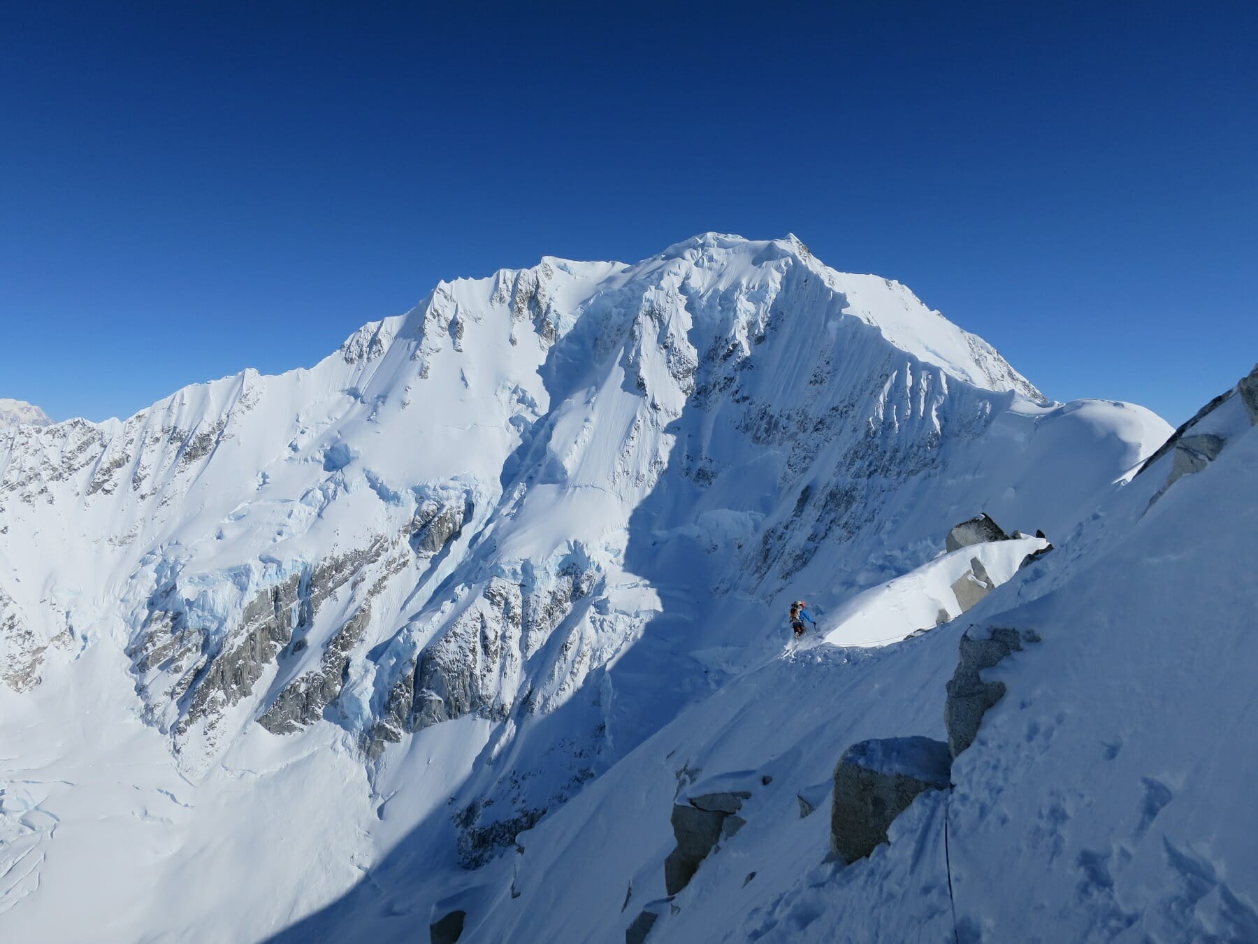
Jason Stuckey heading down to the col between Laurens and Gabriel. (Photo credit: John Giraldo)
As the ridge became a bit broader, I took over the lead and began trudging through knee-deep snow. I was surprised at how quickly I was moving, as trail-breaking had never been my strong suit before I had started training with Steve. I was feeling pretty pleased with myself, in fact, when all of a sudden a 50-foot-long section of cornice released under my feet. I watched in terror as it fell down the side of the mountain, taking some of my footprints with it. Once my heart rate returned to normal and I had regained my composure, the going was pretty smooth from there to our next bivy. As we settled in for the evening we enjoyed an incredible sunset over the mountains stretching off into the distance.
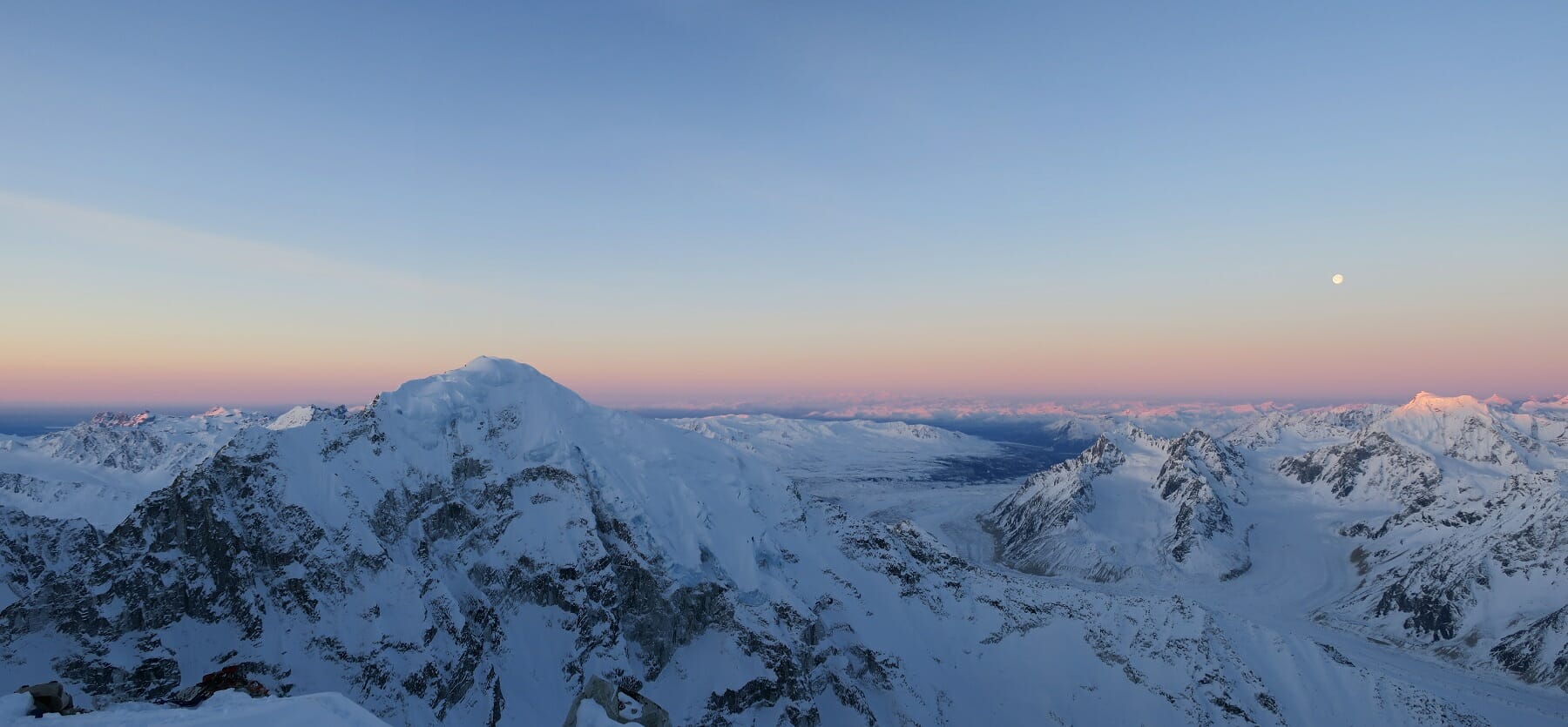
Sunset during the evening of day 2 from our bivy site. (Photo credit: Jason Stuckey)
At 5 a.m. we got up, left most of our gear, and went light and fast up the remaining ridgeline to the summit, staying well below the crest of the corniced ridge (having both learned our lessons the day before). After about 4 hours of climbing, we found ourselves at the western summit. From where we stood, it appeared the eastern summit was just barely taller. Rather than leave anything undone, we headed over and tagged that one, too. From there, we took in the amazing views of some of North America’s most iconic peaks and routes: The Infinite Spur on Foraker, Hunter’s South Ridge and North Buttress, the Southwest Face of Denali, and the Cassin Ridge—it was absolutely incredible.
After a few summit photos it was time to head down. John led out as we downclimbed back across sketchy snow fins and steep snow slopes, arriving at our camp at 5 p.m. We brewed up, ate, packed, and started our descent around 6:30 p.m. We made our way back to the col, traversed a few pitches into a big couloir, downclimbed a few thousand feet to our skis, and were back at camp at 11 p.m. that night.
Now, for the time being, the focus is back to training and my job up in the Arctic at a remote field station. I used to go on trips every six to eight weeks, as my schedule allowed. But since working with Steve, I’ve had to cut back, as all the trips made consistent training nearly impossible for me. “Short-term sacrifice for long-term goals,” Steve kept telling me. Now that I see the results, I understand what he was talking about. So I take fewer trips, but tackle bigger, harder objectives. So what comes next? You’ll just have to wait and see!
-by Jason Stuckey
1:1 Coaching
Personalized and direct accountability for your training